


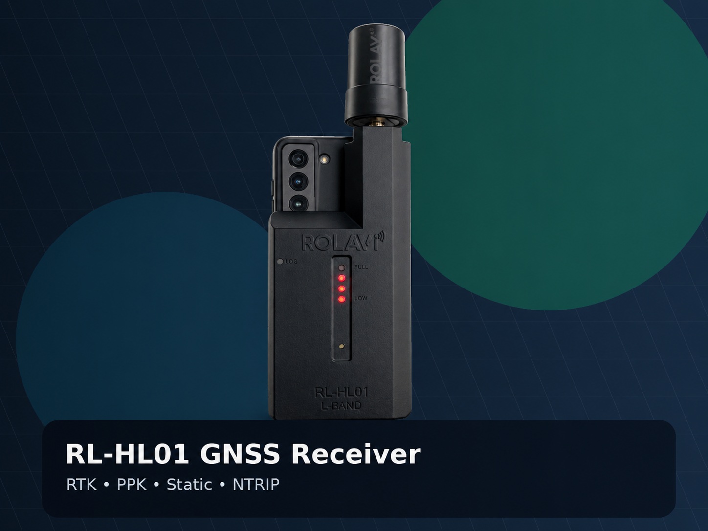
RTK-ready positioning
Use RL-HL01 or RL-HL02 to support RTK, PPK, Static and NTRIP field workflows.
ROLAVIScan
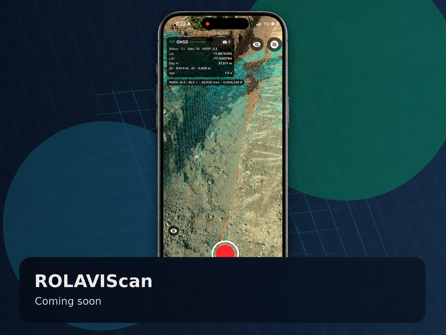
Capture georeferenced 3D data, survey and stake out with RTK, visualize points, pipelines and models in AR, and run photogrammetry workflows directly from iPhone and iPad.

ROLAVICam
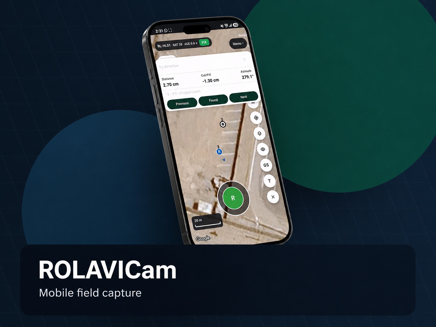
Capture visual evidence, connect RTK positioning, organize field data and move every project from site documentation to professional deliverables.

Why ROLAVI
Inspired by modern mobile mapping workflows, ROLAVI brings together GNSS receivers, mobile capture, scanning, processing and deliverable preparation in one modular environment.
Use RL-HL01 or RL-HL02 to support RTK, PPK, Static and NTRIP field workflows.
ROLAVICam helps document conditions, progress and visual context directly from the job site.
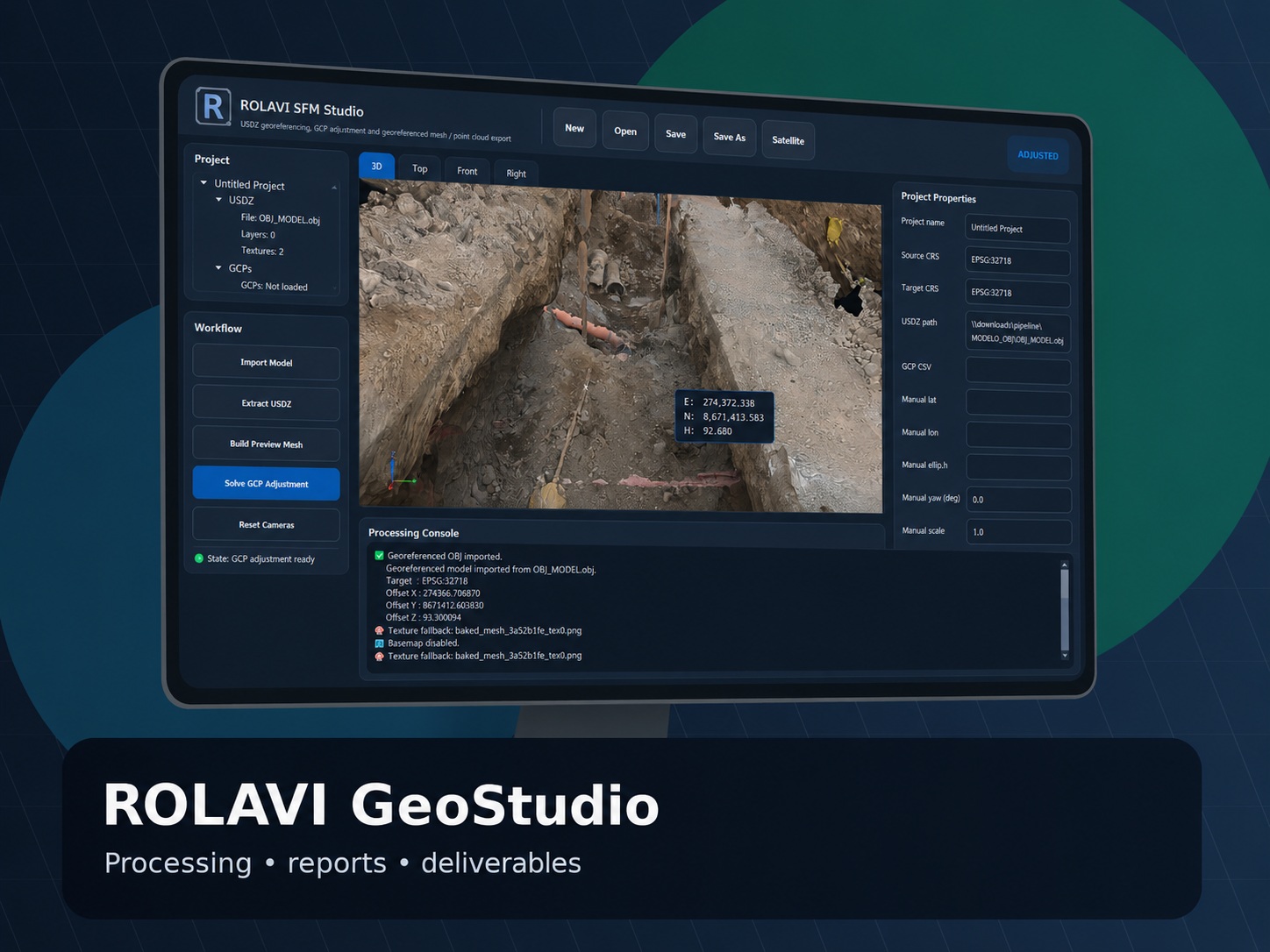
ROLAVI GEOStudio is positioned as the office space to review, organize and prepare project outputs.
Prepare data for CAD, GIS, reports, site verification and client-ready documentation.
Connect with ROLAVI through WhatsApp, manuals and video tutorials for faster adoption.
ROLAVI ecosystem
The ecosystem is organized as a modular workflow. Each tool has a clear role, so the user knows what to capture, how to position it, where to process it and how to deliver it.
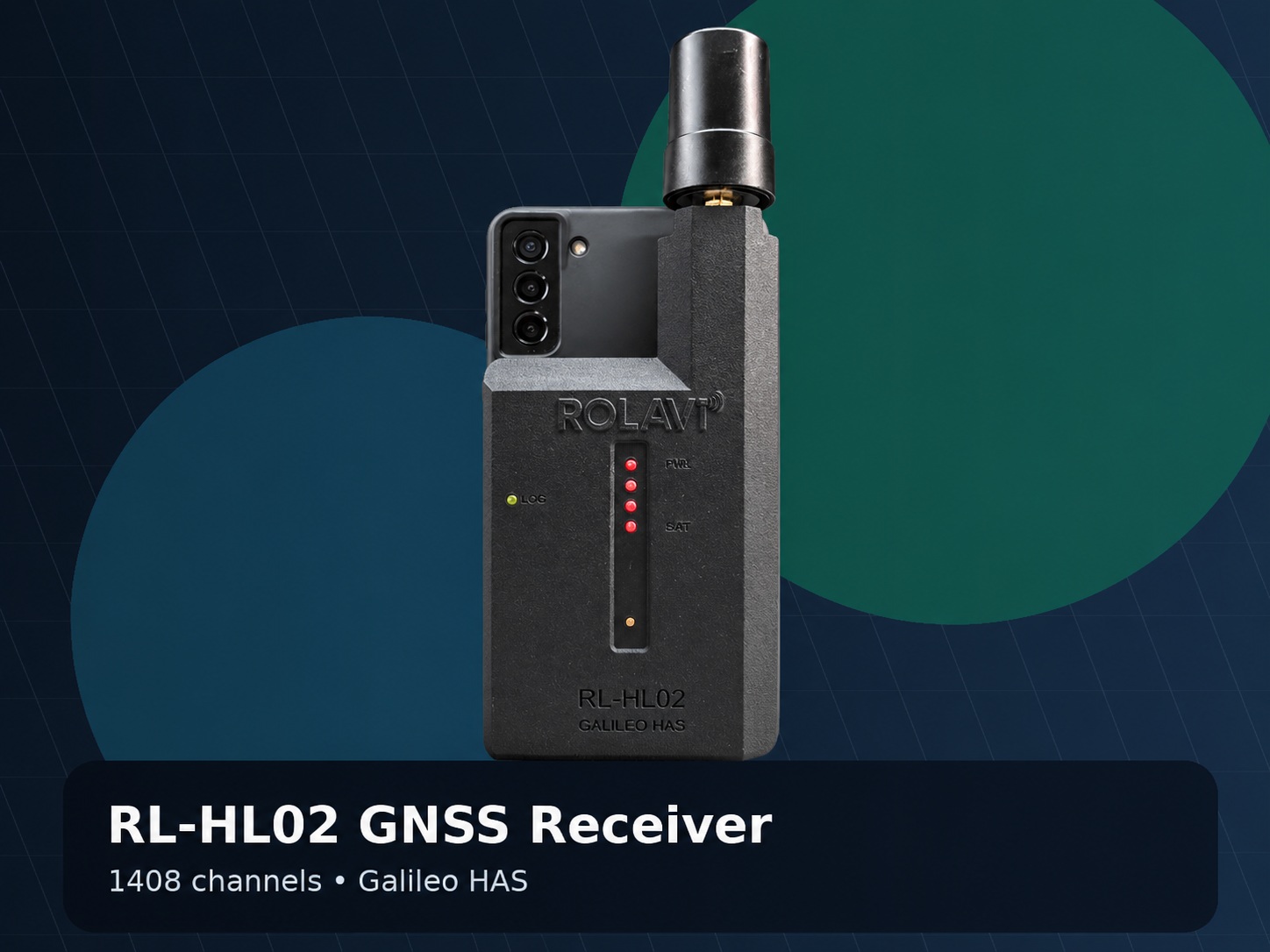
RL-HL01 and RL-HL02 provide GNSS positioning support for RTK, PPK, Static and NTRIP workflows.
ROLAVIScan brings LiDAR scanning, GNSS surveying, augmented reality and photogrammetry to iPhone and iPad, while ROLAVICam focuses on fast GNSS-connected visual capture.
ROLAVICam, Apglos Survey Wizard, TcpGPS and SW Maps can be presented as part of the field-to-office software environment.
Use ROLAVICam to capture video, photos and field context. Add notes and organize the site evidence by project.
Connect your GNSS workflow with RL-HL01 or RL-HL02 depending on the required satellite tracking and project needs.
Review coverage, project records and field consistency before moving data into the office workflow.
Move data into ROLAVI GEOStudio or compatible field software workflows for organization, review and deliverable preparation.
Prepare reports, points, maps, CAD/GIS data, visual evidence and project documentation for clients and internal teams.
ROLAVI workflow
ROLAVI guides users through a practical geospatial workflow: capture field evidence with ROLAVICam, add precise GNSS positioning with RL-HL01 or RL-HL02, process and organize data in ROLAVI GEOStudio, and prepare professional deliverables for surveying, photogrammetry, videogrammetry, drone mapping, AR visualization and CAD/GIS projects.
Use ROLAVICam to document the terrain, work progress, field conditions and visual context directly from the job site. The video area is loaded from YouTube, so the website stays light.
Connect the field capture workflow with ROLAVI GNSS receivers. Select RL-HL01 for compact GNSS work or RL-HL02 when a higher channel receiver and Galileo HAS support are needed.
ROLAVI GEOStudio is the office workspace for post-processing, RINEX conversion, videogrammetry, photogrammetry, drone workflows and AR-ready file preparation. Click the image to enlarge it.
Why ROLAVI
ROLAVI works as a practical field companion across the full ROLAVI ecosystem. It can support visual capture, GNSS-connected workflows, project verification and office processing so teams can move from field evidence to professional deliverables with confidence.
Products
Discover ROLAVI receivers, mobile applications and geospatial software designed for RTK surveying, PPK workflows, field capture, augmented reality visualization, photogrammetry, videogrammetry and professional office deliverables.
Applications
ROLAVICam video
Field teams capture visual evidence with ROLAVICam, connect ROLAVI GNSS receivers for precise positioning, verify project information on site, and then process the data in ROLAVI GEOStudio to prepare professional reports, maps, geotagged outputs, 3D models and AR-ready deliverables.
Featured video
Watch how mobile capture, RTK positioning, AR documentation and geospatial processing can become part of a practical field-to-office workflow.
Connect with our team to learn more about ROLAVI GNSS receivers, ROLAVICam, ROLAVIScan and ROLAVI GEOStudio. We will help you choose the right workflow for surveying, RTK/PPK positioning, mobile capture, photogrammetry, videogrammetry, AR visualization and professional geospatial deliverables.