


ROLAVI products for RTK surveying, mobile mapping and geospatial processing.

Explore the ROLAVI ecosystem: GNSS receivers for precise field positioning, mobile applications for capture and AR workflows, and desktop software for post-processing, reports and professional deliverables.

ROLAVI ecosystem

Hardware and software designed to work together.

ROLAVI combines GNSS receivers, mobile field applications and office software to support topographic surveying, drone mapping, photogrammetry, videogrammetry, AR visualization and geospatial project delivery.

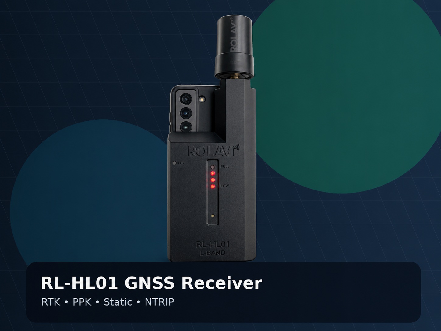
RL-HL01 GNSS Receiver
RTKPPKStaticNTRIP

RL-HL01 GNSS Receiver

US$1,699

The ROLAVI RL-HL01 is a compact GNSS receiver designed for professional surveying workflows that require reliable positioning in the field. It is ideal for RTK rover work, PPK projects, static observations, NTRIP corrections and drone mapping support.

  • Compact GNSS receiver for field surveying and mapping
  • Supports RTK, PPK, Static and NTRIP workflows
  • 184 channels for multi-constellation tracking
  • L1, L2 and E5 frequency support
  • GPS, GLONASS, Galileo and BeiDou compatibility
  • Bluetooth connectivity for mobile applications
  • SD card support up to 32 GB for data storage
  • Suitable for topographic work, drone base workflows and field control
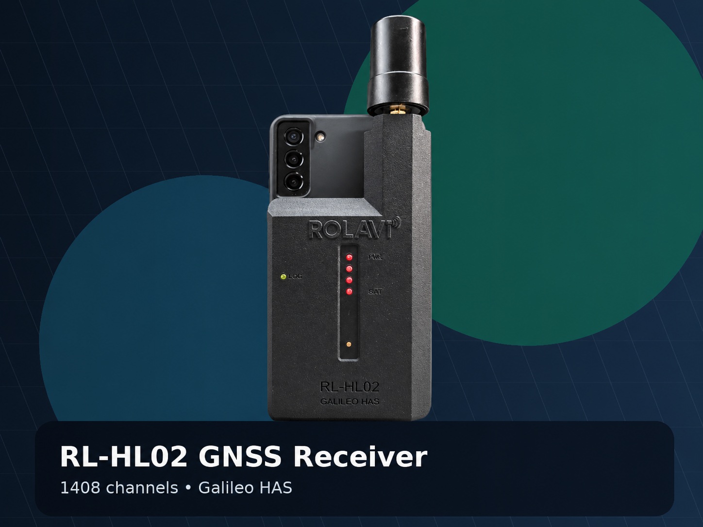
RL-HL02 GNSS Receiver
RTKPPKStaticNTRIPGalileo HAS

RL-HL02 GNSS Receiver

US$1,899

The ROLAVI RL-HL02 is a higher-performance GNSS receiver built for demanding field teams that need advanced satellite tracking and robust positioning capabilities. With Galileo HAS support, it offers an excellent option for users looking for modern GNSS performance without relying only on paid correction services.

  • Professional GNSS receiver for advanced RTK and PPK workflows
  • Supports RTK, PPK, Static and NTRIP operation
  • 1408 channels for robust multi-constellation tracking
  • L1, L2, L5 and E6 frequency support
  • GPS, GLONASS, Galileo and BeiDou compatibility
  • Free Galileo HAS support
  • Bluetooth connectivity for mobile field applications
  • SD card support up to 32 GB for raw data and project records
  • Recommended for high-demand surveying, drone, PPK and geodetic workflows
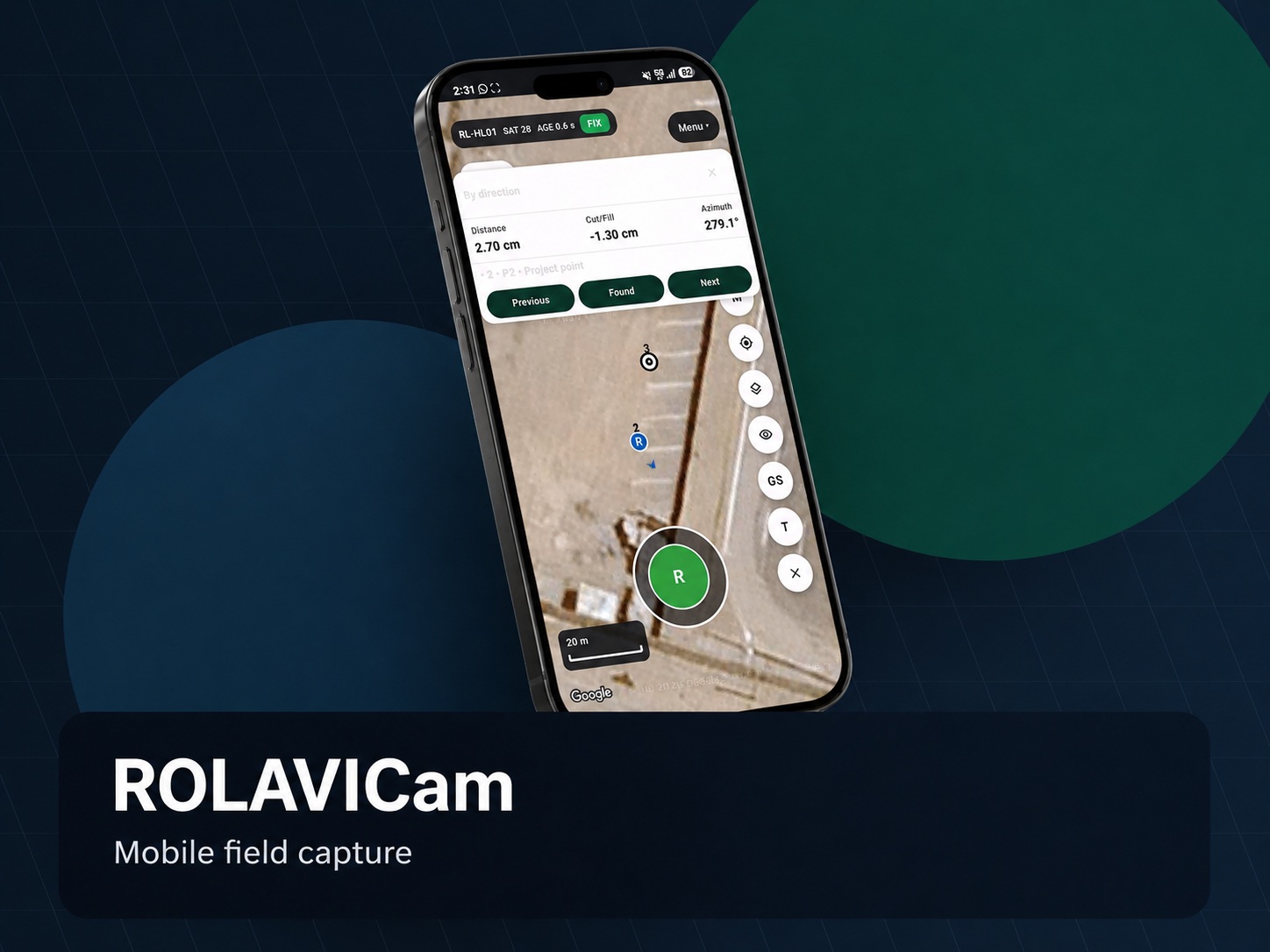
ROLAVICam mobile application
Mobile captureRTK field workStakeoutAR

ROLAVICam Mobile Field App

Contact us

ROLAVICam transforms a mobile device into a practical field companion for surveyors and geospatial teams. It supports visual documentation, GNSS-connected workflows, topographic point capture, stakeout support, field evidence and mobile project records.

  • Mobile field capture for surveying and geospatial documentation
  • Designed to work with ROLAVI GNSS receivers
  • Useful for topographic surveying, field notes and visual evidence
  • Supports workflows for photo, video and project documentation
  • Can support stakeout and AR-assisted field visualization workflows
  • Ideal for construction verification, road projects and asset records
  • Connects the field team with the ROLAVI processing ecosystem
ROLAVIScan professional LiDAR, GNSS and augmented reality workflow
iPhone & iPadLiDARGNSS RTKARPhotogrammetry

ROLAVIScan Professional LiDAR, GNSS & AR

iPhone & iPad

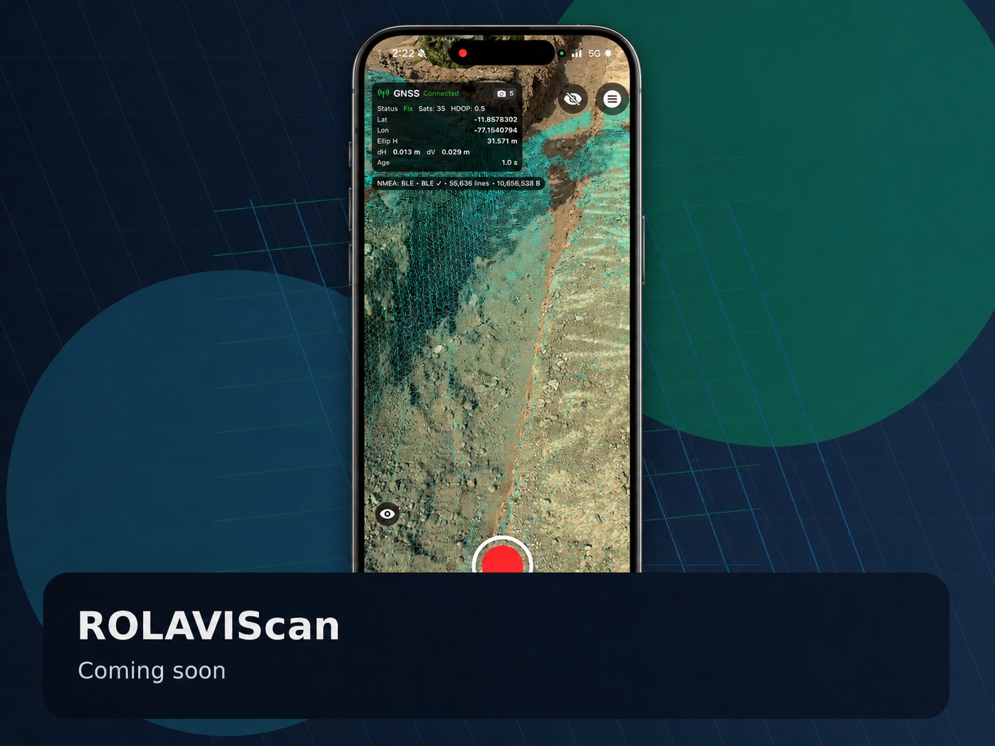
ROLAVIScan is a professional field application for LiDAR scanning, GNSS surveying, augmented reality, photogrammetry and georeferenced 3D documentation. It connects field capture on iPhone and iPad with ROLAVI receivers and ROLAVI GEOStudio workflows.

  • LiDAR point clouds, meshes and colorized 3D capture
  • GNSS RTK surveying, point collection and stakeout
  • AR visualization of points, pipelines, polygons and textured 3D models
  • Photogrammetry, camera–LiDAR and 3D Gaussian Splatting workflows
  • CAD, GIS and georeferenced project import/export
  • Project organization, raw GNSS logging and quality-control tools
  • Designed to work with ROLAVI receivers and compatible GNSS sources
ROLAVI GEOStudio processing software
PPKRINEXVideogrammetryAR export

ROLAVI GEOStudio Geospatial Processing Software

Contact us

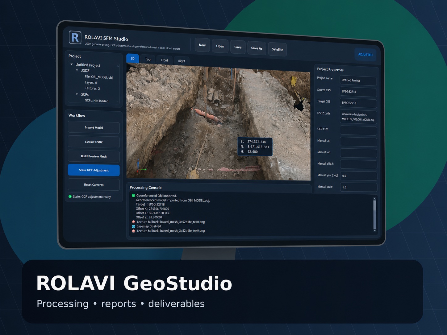
ROLAVI GEOStudio is the office processing environment for ROLAVI field workflows. It helps organize, review and process geospatial data from GNSS, drones, mobile capture, videogrammetry, photogrammetry and textured 3D models.

  • RINEX conversion and GNSS data preparation
  • PPK workflows for drone, mobile and field-capture projects
  • Static and post-processing workflows for GNSS observations
  • Photo and video geotagging workflows
  • Videogrammetry processing and map generation
  • Drone mapping project support and geotagged deliverables
  • LAS, LAZ, PLY and textured model workflow support
  • OBJ, USDZ and ROLAVIAR preparation for AR visualization
  • Reports, maps and deliverables for CAD/GIS environments

GNSS receiver comparison

Choose the right ROLAVI receiver for your workflow.

The RL-HL01 is a compact and practical receiver for standard RTK, PPK, Static and NTRIP workflows. The RL-HL02 is recommended when the project requires higher-channel tracking and Galileo HAS support.

Feature RL-HL01 RL-HL02
Recommended use Compact RTK, PPK, Static and NTRIP field workflows Advanced GNSS tracking, PPK, RTK and Galileo HAS workflows
Price US$1,699 US$1,899
Positioning modes RTK, PPK, Static, NTRIP RTK, PPK, Static, NTRIP
Channels 184 channels 1408 channels
Frequencies L1, L2, E5 L1, L2, L5, E6
Constellations GPS, GLONASS, Galileo, BeiDou GPS, GLONASS, Galileo, BeiDou
Additional advantage Compact option for practical field GNSS workflows Free Galileo HAS support for advanced correction workflows

Need help choosing the right ROLAVI solution?

Contact ROLAVI and tell us your project type: topographic survey, drone mapping, PPK, photogrammetry, videogrammetry, AR visualization or field documentation.